From shows to commercial discovery
The 2018 confirmation of a discovery in the northern North Sea is another example that persistence is beneficial to petroleum exploration.
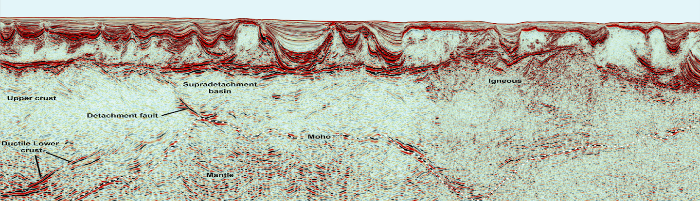
The regional line shown below transects the Ryggsteinen Ridge on the Horda Platform in the prolific northern North Sea oil and gas province. While the line connects the Troll, Fram and Nova fields, with the Grosbeak discovery in between, several other discoveries and fields are located both to the east and west.
35/9-7 (Skarfjell), operated by Wintershall, was drilled in 2012 and found light oil in two intervals, an Oxfordian – Kimmeridgian sandstone (69m gross) and a Callovian sandstone (14m gross).
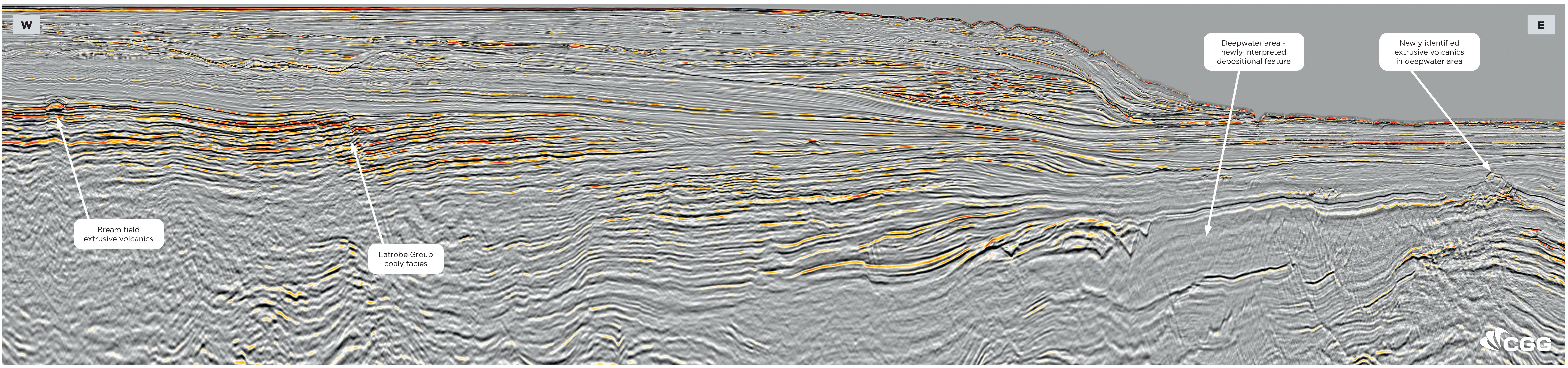
The following year, appraisal well 35/9-8 was drilled 1.9 kilometres north of the 35/9-7 discovery well. The well encountered oil with a gross reservoir of 135m. Results from the CGG Well study, as shown in the well correlation illustration, identifies the reservoir as two sand units of Oxfordian and Kimmeridgian age.
Appraisal well 35/9-10 S, was drilled in 2013 on the southern extent of the “Skarfjell structure”. The well encountered a 13m gross gas column and an oil column of 49m gross, in Oxfordian – Kimmeridgian sands. A Callovian sand interval also encountered oil with a gross reservoir thickness of 16m. Pressure data indicates that the Oxfordian – Kimmeridgian sandstones have different pressure gradients from the Callovian sands and that this area is not in direct communication with the western and northern part of the discovery. In May 2018, Wintershall submitted a plan for development and operation (PDO) for what is now known as the Nova oil field. The recoverable reserves are expected to be about 77 million barrels of oil (bo).
35/11-7 (Fram East) was drilled by Mobil Exploration Norway in 1992 as an appraisal well on the 35/11-4 (Fram) discovery. Fram comprises two deposits, Fram West and Fram East. Production started in 2003 and 2005, respectively. Fram produces oil and gas, partly from the Brent Group, from marine fan system sandstones of Late Kimmeridgian age and shallow marine sandstones in the Oxfordian – Early Kimmeridgian interval. The reservoirs have a gas cap and lie in several isolated, rotated fault blocks at 2,300-2,500 metres depth. Recoverable reserves were originally 240MMbo and 94MMboe of gas and NGL.
The story behind the discovery of Grosbeak is told in GEO 08/2018.

© CGG

© CGG