“For the so-called Class A wells, we have had an approximately 90 per cent success rate on our predictions”, said Øyvind Sylta, Managing Director at Migris during the NCS Exploration – Recent Advances conference on May 20th.
The Trondheim, Norway based consultancy company describes and reduces geological and economical exploration risk by simulating geological processes and visualizing the results in interactive 3D models.
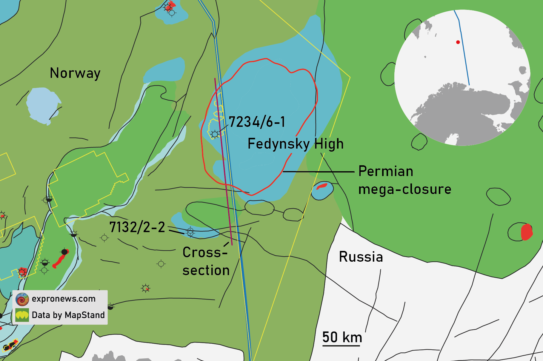
Last year, Migris agreed to predict the outcome of several upcoming wildcats in the North Sea using their own software and presenting their predictions on geoexpro.com.
According to Sylta, the predictions with a flowrisk of more than 75 per cent (Class A wells) resulted in success (hydrocarbons discovered) in 9 out of 10 wells. For the Class B wells (<75 per cent flowrisk) the rate was about 20 per cent.
Flowrisk thus seems to be a good predictor of hydrocarbons. But what is flowrisk?
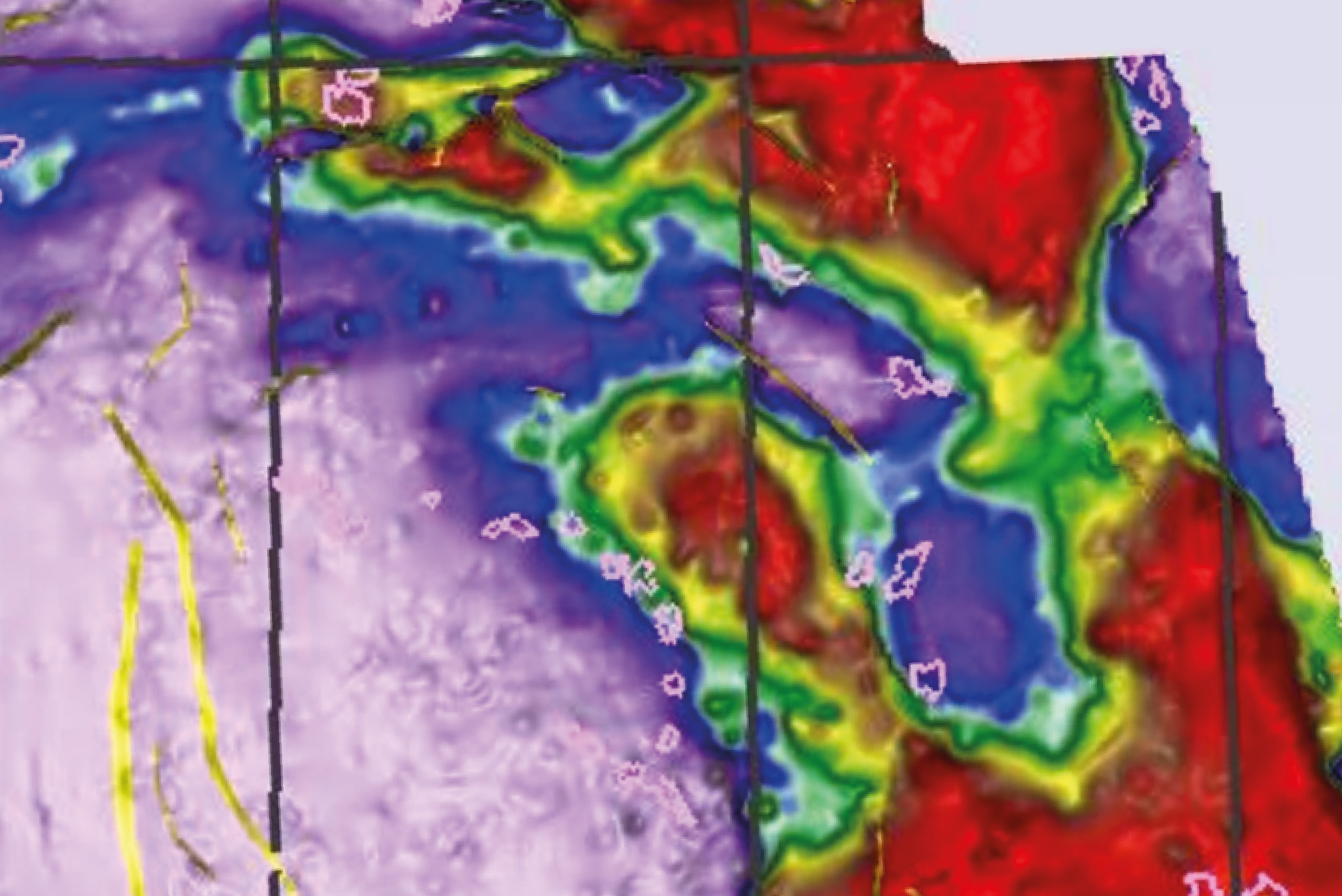
Migris has used their basin modelling software and a number of UKCS public domain datasets to also generate a 3D basin model covering the UK Central North Sea and Moray Firth areas. This high-quality, public 3D basin model can be accessed, visualised and interrogated in Migris software on a trial basis.
A number of the study outputs in the form of images are available on Aeon’s PDR and can be viewed alongside various public domain datasets. More results from this project – such as grids and maps – are to be included soon. A unique & dynamic way to evaluate CNS & MF source rocks!
Sign up here for the free-to-access PDR.
Thousands of simulations
The flowrisk percentage (0 – 100) is basically the probability of hydrocarbons having migrated through (charged) a certain area.
With the flowrisk analysis Migris takes an alternative approach when it comes to reducing exploration risks that differs from the widely used technologies seismic AVO (including rock physics), EM and deterministic petroleum system analysis.
Instead, they use a stochastic petroleum systems modelling approach in which a full 3D petroleum geomodel is simulated through geological time within a Monte Carlo loop. The loop consists of thousands of simulations incorporating hundreds of parameters. The method was developed around 2010.
For every run of the model, there is a probability that a certain area or reservoir will be charged with hydrocarbons. During the thousands of runs, some areas will get charged over and over again, while other areas hardly see any hydrocarbons migrating into them.

Faults and near-field exploration
“While our success rate on the NCS has been high, there is still room for improvement,” Sylta continued.
For instance, the Migris software can’t predict the presence of a reservoir, although stochastic descriptions of reservoir thicknesses and flow properties may provide feedback to the geologist in some cases.
The flowrisk methodology does not allow the calculation of trap volumes. Instead, but quantitative predictions can be made in close cooperation with the operator using local reservoir maps, according to the Migris director. Other reasons for dry wells in high flowrisk areas may include fault seals and leakages.
Mapping faults is therefore on Migris’ agenda, and Sylta told the conference participants that they have started to implement a software for automatic simulation within fault surfaces using automatic fault interpretations from e.g. PaleoScanTM.
Further improvements will come from predictions that will include uncertainties of phases and their properties, as well as automatic 3D calibration of charge models in near-field exploration.
The NCS Exploration conference has been recorded and can be viewed until June 10th, meaning it’s still possible to register. PROGRAM AND REGISTRATION
RONNY SETSÅ