“…the practical ability to conduct measurements covering vast expanses of terrain at a reasonable cost and to carry out uninterrupted exploration renders the geologist’s conclusions much more reliable. Having obtained an overview, he can correctly extrapolate local observations made on outcrops…”
Conrad Schlumberger, 1930
Although humans have been using hydrocarbons as an energy source for centuries, the discovery of the majority of oil accumulations before the 20th century had been the result of digging or drilling near known oil and gas seeps.
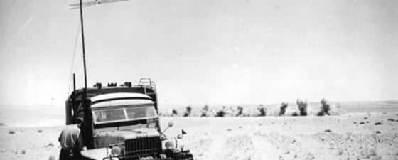
So when German engineer Ludger Mintrop began experimenting with using the way sound travels through the earth to locate the position of heavy artillery pieces during World War I, he had little idea that his work would have important and more peaceable applications. But by 1924 his method of estimating the depth to geological formations by setting off an explosion and measuring the time taken for refracted sound waves to travel through rocks had already been used to discover an oilfield in Texas. At the same time, American engineer J. Clarence Karcher was working on a seismograph which could record surface-generated sound waves reflected from horizons deep within the earth, resulting in 1928 in the first oil discovery by seismic reflection.
Meanwhile, in France, Conrad Schlumberger had been experimenting with measuring the electrical resistivity of the earth since 1912, proving that electrical soundings could be used to build up a picture of the layering of strata within the earth. He undertook the first large scale petroleum survey using this method in 1923, and he and his brother Marcel founded the Société de Prospection Electrique (SPE) in 1926, specialising in using geophysical techniques to identify subsurface features. By 1927 they were experimenting with identifying changes in vertical electrical measurements through the earth – the precursors of wireline logging.
Worldwide Expansion
 Source: CGGVeritas
 Source: CGGVeritas SPE fell into difficulties with the 1929 stock market crash, but out of it emerged Compagnie Générale de Géophysique (CGG), founded by Conrad Schlumberger in 1931. By 1932 the new company was using geophysical techniques to look for oil in West Africa, and within a decade CGG had survey teams in places as far apart as India, the Middle East, North America and Venezuela.
Sadly, Conrad died in 1936, but the techniques he had devised and the company he had nurtured continued to grow through the 30s. As with most companies in France, WWII proved taxing, and the staff was considerably reduced, but they managed to undertake surveys until 1944, when the German occupying forces confiscated their equipment.
Liberation brought encouragement from the new French Government, and the revamped company spread back around the world, especially into those areas which had a strong French influence, the Sahara in particular. Expansion continued in the 50s, with the number of crew/months increasing by 20% per year between 1950 and 1955 alone. In 1956, the Schlumberger group withdrew completely from the capital of CGG. That same year the Sercel subsidiary was created. Initially called Société de Fabrication de Matériel Géophysique, it was renamed Société d’Etudes, de Recherches et de Constructions Electroniques (Sercel) in 1962 when it began to offer its technology to other companies.
Rapidly Developing Technology
 Source: CGGVeritas
 Source: CGGVeritasRapidly developing geophysical techniques, including gravimetry, seismic refraction and tellurics, had been used to undertake reconnaissance surveys of many new areas in the 1930s and to identify and rank potential hydrocarbon traps. By the end of the 1940s these were enhanced by additional techniques like geochemistry, radiometry, electromagnetism and induced polarisation. By the end of the 50s airborne magnetometer surveys had become a routine reconnaissance survey method, hugely increasing the potential for developing new areas.
Seismic reflection, now a mainstay of hydrocarbon exploration, was only used sporadically by CGG until the 1950s, by which time its engineers had worked extensively on methodologies to process data by correcting the various effects of wave propagation in the subsurface. Progress had also been made with the development of non-explosive seismic sources, such as vibrator trucks – all resulting in large amounts of data in need of processing.
Geophysical measurements were recorded on photographic paper in the 1930s, but these were not reproducible until the introduction of magnetic tape records two decades later. By the early 1950s CGG had acquired an analogue computing centre for playing back field data, although there was little ability to process the data. At the same time, the introduction of the Common Depth Point (CDP) recording method significantly reduced noise (extraneous and multiple signals) by combining signals from many sensors. But the use of such intricate and involved processing inevitably required assistance and in 1954 CGG bought its first computer, moving the company rapidly into the computer age and the digital revolution.
In 1963 the concept of deconvolution – the filtering of data to eliminate distortion of the signal – was introduced, also requiring increased processing power. However, the processing of seismic data at CGG did not commence in earnest until late 1967 with the purchase of new EMR computers designed to substantially increase the subsurface image quality.
Many innovations of that time came from Sercel, which came up with technological developments, such as a 24-trace transistor amplifier, introduced in 1962, whose small size and low power requirement made a huge difference to field operations. The turning point came with the launch of the SN 328 in 1968. The company was constantly upgrading and improving its equipment, and in 1971, its latest product, SN 338, was at the cutting edge of data acquisition technology. Through such innovations Sercel, in the space of one technological generation, gave CGG and the industry a previously unattainable understanding and application of geophysics.
Moving Offshore
In 1960 the Schlumberger family, which in 1953 still owned 47% of CGG, finally sold its holdings, signalling the end of an era. Over the next decade the newly independent company went from strength to strength, establishing itself in new regions and getting a good foothold in US and Russian markets. At the same time, technology was moving ahead and by the end of the 60s digital recording meant that several thousand traces could be simultaneously recorded and then processed.
During the 1960s the industry gradually moved offshore. CGG’s first dual vessel survey had been undertaken in 1958, with one boat as source, initially using an underwater dynamite charge but rapidly progressing to safer air or steam sources, and a second boat towing the streamer recording the seabed reflections. Single source marine exploration, with source and receivers on the same vessel, was introduced in 1964. The initial seismic vessels were converted stern trawlers, and the crew could spend up to nine months at sea – things have changed a lot since then!
CGG first experimented with 3D surveys in 1971, known then as Wide-Line Profiling, by towing three parallel streamers, but this did not come into general industry usage until the 1980s, with seismic vessels equipped with onboard processing centres undertaking 24-hour operations. Recording capacity increased, computer technology had to keep up with this, and in 1984 CGG installed the largest computer of the time, the Cray 1S, in its main processing centre at Massy outside Paris. This was able to deal with the recently developed concept of migration, which moves the seismic record to its true position.
The widespread use of 3D resulted in a race to systems which offered an integrated package of data acquisition, processing and interpretation.
Strategic Partnerships
 By 1961 CGG had four MT4 centres processing magnetic tape. Source: CGGVeritasBy the time CGG floated on the Paris Stock Exchange in 1981, it had a consolidated turnover of €450 million, owned more than 100 vibrator trucks and recording units, 170,000 geophones, 1,300 off-road vehicles, seven seismic vessels and several ‘supercomputers’. It had operations throughout the world and had survived a number of major industry downturns and a host of geopolitical events. Competitiveness and productivity had been key to survival, with ever greater volumes of data being acquired with minimum expense and mobilisation cost.
Growth continued throughout the 80s and 90s, despite the inevitable challenges resulting from events like major industry downturns and the two Gulf Wars. The focus was on designing the best technology for ever-changing circumstances. 3D became more important, on land as well as at sea, and with the search for oil moving into ever more complex areas, high definition depth imaging technology was developed. In 1994 CGG carried out the first 4D seismic surveys, returning to a survey area to add the dimension of time to the 3D acquisition.
Much of CGG’s success can be attributed to careful strategic partnerships with other companies, both for practical operational reasons and to ensure the company had the correct skill sets. As far back as 1966, for example, ARGAS, a limited liability partnership between Industrialization and Energy Services Company (TAQA) and CGG, was created which today provides geophysical services and R&D for petroleum, mining and ground water resources mainly in Saudi Arabia. During the same year, the growth of the airborne reconnaissance surveys had been led by Geoterrex, a combination of CGG and Canadian Terra Survey. Strategic alliances with Russian and Chinese companies in the 70s and 80s allowed CGG to make substantial inroads into those countries. Similarly, in the 90s, a joint venture with Total gave CGG expertise in integrated reservoir studies.
CGG and Veritas Join Forces
 The Oceanic Sirius, the latest vessel to join the CGGVeritas fleet, was christened in October this year.
 Veritas set up the first new generation Data Visualisation Centre in Houston in the 1990s. Source: CGGVeritasIn 1965 six engineers and geophysicists sharing the then revolutionary vision of bringing digital computing technology to the geophysical industry, got together in Houston to form Digital Consultants Inc. – each contributing $334 as starting capital. Before long they were undertaking their first surveys, on and offshore, using state-of-the-art computers that allowed multi-trace, multi-task programming without tape output, and by 1969 they had reformed as Digicon and were on the US Stock Exchange. This new company remained at the forefront of technology, deploying the first digital marine seismic streamer in 1979 and initiating commercial depth migration the same year. In 1981 Digicon employee John Sherwood invented the key DMO (Dip Move Out) data processing technique.
Meanwhile, by 1978 Veritas Energy Services, established in Calgary four years earlier, was revolutionising processing speeds through the use of FPS (Floating Point Systems) processing units. In 1982 it processed the industry’s first-ever 3D seismic survey, in Canada, and ten years later launched the ‘SAGE’ data processing system, probably the most advanced production processing system available at the time.
In 1996 Digicon and Veritas combined as Veritas DGC Inc., and the new company proceeded to set records by towing the industry’s first 12 km streamer and setting up the first visualisation centres. Over the next few years it extended its capabilities further through acquisitions like Time Seismic Exchange, a land seismic data library based in Canada, and Guardian Data Systems, a data archiving and transcription company in Australia.
In 2005, the year of its 40th anniversary, Veritas also acquired the Hampson-Russell seismic interpretation software group. In 2006 CGG notched up 75 years in the business; the following year these two well established companies joined forces to create CGGVeritas, a leading global geophysical services and equipment company. Since then, the combined company has gone from strength to strength, financially, technologically and operationally.
All showing that innovation, research, sharing, teamwork and commitment can bring great rewards. Here’s to the next 80 years!


