“The increase in operational efficiency and scale of the operation is now making OBN competitive with conventional 3D streamer seismic and is a step change in the seismic market”, Kristian Zahl, VP sales with Axxis Geo Solutions (AGS), says.
AGS and JV partner TGS, along with pre-funding partners AkerBP and Equinor, are now in the final stage of acquiring some 1600 km of the North Sea’s first multi-client Ocean Bottom Node survey (OBN) that – according to JV partners AGS and TGS – has the potential to be of value not only for exploration, but also for the delineation of discoveries, field development and reservoir management.
Story continues below the map

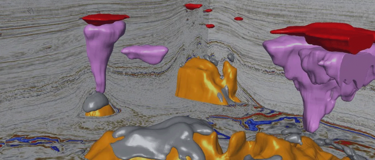
Illustration: AGS
The next wave
“Exploration in the Norwegian sector is in a mature phase, and many prospects are dependent on improved seismic data”, Are Osen, Exploration Manager Geophysics with Aker BP says.
Deeply buried in the South Viking Graben there is a massive layer of black shale that has proven to be an excellent source rock for oil and gas. Thanks to a favourable burial history, several prolific oil and gas fields have been found and put in production.
But there is more to come.
Oil companies hunting new exciting discoveries have licensed the larger part of the fairway. Given a mature basin with detailed geological knowledge in combination with advanced infrastructure, there is good reason to believe that many exploration wells will be drilled in the near future.
To minimize risk and make sure drilling is taking place on the best prospects, the oil companies are therefore always eager to get access to the best possible seismic data. For a long time, broadband 3D streamer data have been the preferred choice. But times are changing. The next wave in exploring mature areas will be able to turn to ocean bottom seismic. Or, to be more specific, Ocean Bottom Nodes (OBN).
Taking advantage new improved acquisition technology, Aker BP has over a number of years worked to improve seismic data quality.
“Ocean Bottom Seismic (OBS) was at an early stage identified as a possible quantum leap in data quality for exploration on the Norwegian continental shelf. Through the company’s experience with OBS from the fields we operate, we looked for an opportunity to do a large OBS exploration programme”, says Osen.
“Our experiences from an OBS programme carried out over the Ivar Aasen field in 2013, as well as cooperation in other licenses where OBN seismic has been acquired, laid the foundation for our Business Case for a large-scale acquisition of OBN for exploration,” he says.
“Interpretation of the data provided a significantly improved structural model for Ivar Aasen, and this laid the ground for better planning of where to locate the production wells. In addition, this Ocean Bottom Node (OBN) survey provided the basis for possible reservoir monitoring, and the first 4D acquisition was completed in 2019”.
Increased efficiency
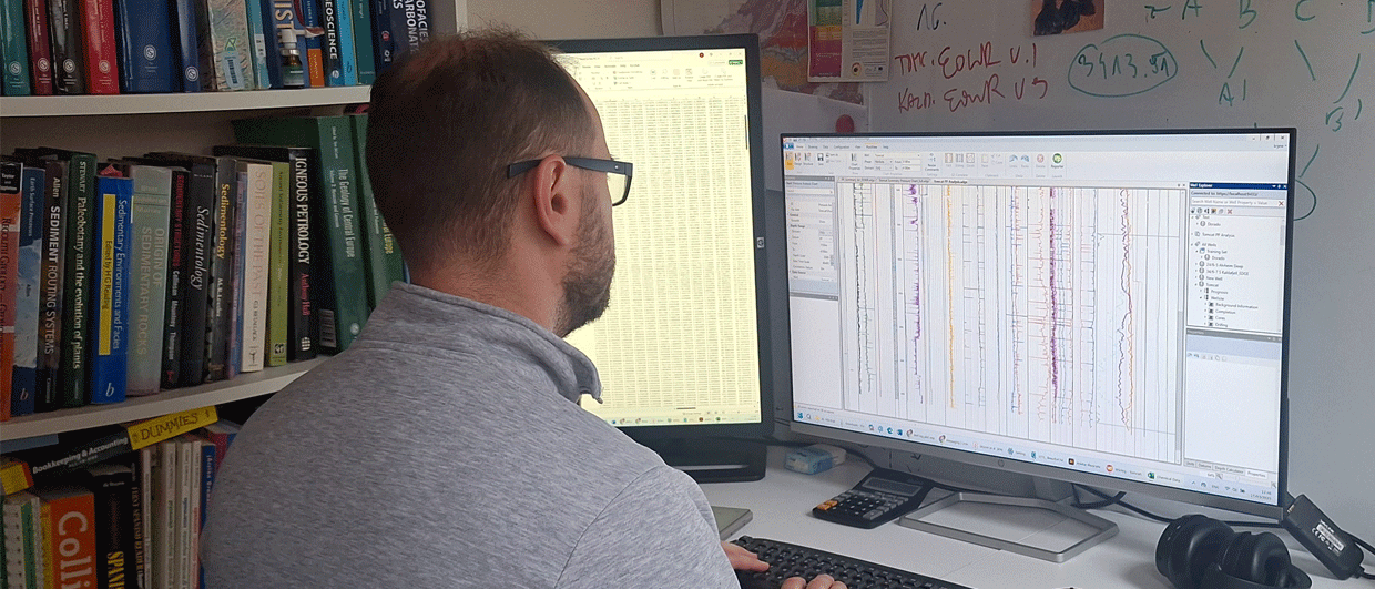
Getting close to finalization of the survey, the AGS staff is very proud of the efficiency with which the data has been acquired. “With three sources on three vessels, coupled with the possibility to undertake de-blending and thereby avoiding down-time because of time sharing, we can do 60 000 shot points and a coverage of 20-25 km2 per day. In this way we have achieved a substantial increase in efficiency which can help reduce cost”, says Andrew Cushnaghan, Project Manager in AGS. And, not to forget, it seems as if he is able to get the survey done within the allotted time frame.
Aker BP is strongly involved in the survey and is pleased with the operation.
“Our experience after a delayed start in 2018 is that the efficiency of the current season is in line with expectations”, says Osen.
Illustration: AGS
A huge operation
According to AGS, with 1200-fold, the survey west of the Utsira High is a step change in both seismic data quality and scale.
“We consider that for full azimuthal coverage, very short and very long offsets as very important for improved illumination”, Lars Jensen, Advisor Geophysics, Norwegian Petroleum Directorate, and, he also thinks it is important that shear waves are recorded.
As a starter, altogether seven vessels have been involved this year, including three source vessels, two node handling vessels and two support vessels, while 9000 nodes have been deployed simultaneously and continuously rolled through the area.
With a layout of receivers on the ocean bottom, the survey achieves full azimuth illumination of the geological features in the area. This is unique for ocean bottom seismic and is generally accepted to generate the very best data that can possibly be achieved using the latest technology. Avoiding streamers also results in operational advantages. Having just finished a survey on the Bombay High in India, AGS knows exactly what it means to operate in busy waters with lots of infrastructure and numerous fishing boats.
“An important component in large OBN projects is the interaction with other offshore activities, and good coordination with the fisheries is considered imperative. This is something that we will also have focus on in the future,” Osen says.
World’s largest
“This is the biggest OBN survey on the Norwegian continental shelf ever, and also the world’s biggest ever multi-client OBN survey”, Zahl says. With a plan to cover 1600 km2 full fold (areal equivalent to some 3 North Sea blocks), he might as well have said it is a world record for an exploration OBN. The amount of data sampled is measured in petabytes.
Processing is of course a challenge. DownUnder Geosolutions (DUG), with their own, cloud-based “huge, geophysically-configured machine in a purpose-built exascale data centre” (DUG McCloud), has been chosen for the job.
“With an enormous amount of data, DUG was one of few processing centres that has the necessary capacity. For us it was also important the they were more than willing to invest in order to get the job done in an efficient way”, Zahl says.
“Today’s processing methods are the result of continuous improvement work from the ideas of the methods, which came in the 1990s, as well as a revolution in computational methods and computational power. We hope that further cost reduction and data improvement will establish OBS data as one of several important exploration technologies”, Osen comments.
Jensen acknowledges that processing will take longer time than what is required for a typical towed streamer 3D survey.
“But this extra time should be worth waiting for, in particular taking into account that the data quality on the preliminary processed version is improved below 2.5 seconds TWT, compared to the best towed streamer 3D in the area”, he says.
Extending the lifetime
Are Osen is fully aware that ocean bottom seismic is not necessarily the solution to all geological challenges in exploration and production.
“In cases where it can have value, we do however see great potential in developing both efficiency and cost reduction, but also within optimal processing of all data provided by the method”.
“The industry should consider performing feasibility studies and look at possibly covering other parts of the Norwegian continental shelf with huge ocean bottom seismic surveys – with improved exploration in mind”, Lars Jensen says.
The data is, however, not limited to exploration.
“With superior quality, the OBN data can also be used in field development and as a base line for 4D, and we must expect that surveys like this one do have a longer lifetime than a 3D marine survey”, Zahl claims.
Kristian Zahl’s vision is also that this type of data – meaning improved imaging of the sub-surface – has the potential to “extend the life of the North Sea”. That may very well be true, as targets get smaller and smaller as production technology also improves.
As always, dreaming big about the future is an exciting exercise.