EMGS has been selected as the acquisition provider for the NTNU ATLAB consortium.
The consortium was formed to study geophysical imaging of geological processes and has received funding from the Norwegian Petroleum Directorate, Aker, CGG, Equinor and NTNU’s Centre for Geophysical Forecasting.
DEEP SEA MINERALS, October 26-27, Bergen, Norway
https://events.geonova.no/event/deepseaminerals/
Norway is in an excellent position to become a leader in the exploration of deep-sea minerals. The race has started, and we will address the challenges and opportunities that lie ahead at this conference.
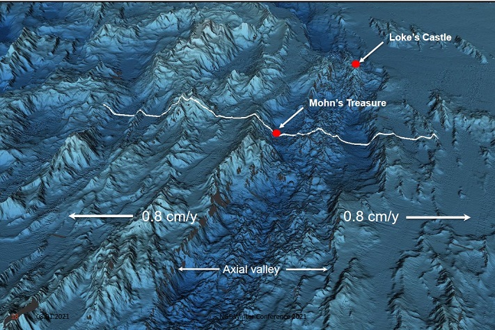
The objective of the ATLAB consortium is to collect a broad range of scientific data at the Mohn’s ridge located in the North Atlantic Ocean between Norway and Greenland, including CSEM, MT, streamer seismic, node seismic, and both chemical and biological data for environmental purposes.
ATLAB project partners include Allton, EMGS, PGS, OFG, TGS, Shearwater, and inApril.
As highlighted by PGS, ATLAB is the first marine minerals research project in the North Atlantic to include seismic data acquisition, using GeoStreamer technology (ca. 200 km).
All data will be acquired using the EMGS vessel Atlantic Guardian.
Ocean Floor Geophysical (OFG) is a key part of the project. OFG has been a participant in the ATLAB consortium since its inception and has been involved in previous marine minerals data acquisitions, run by NPD. OFG will also process the data acquired.
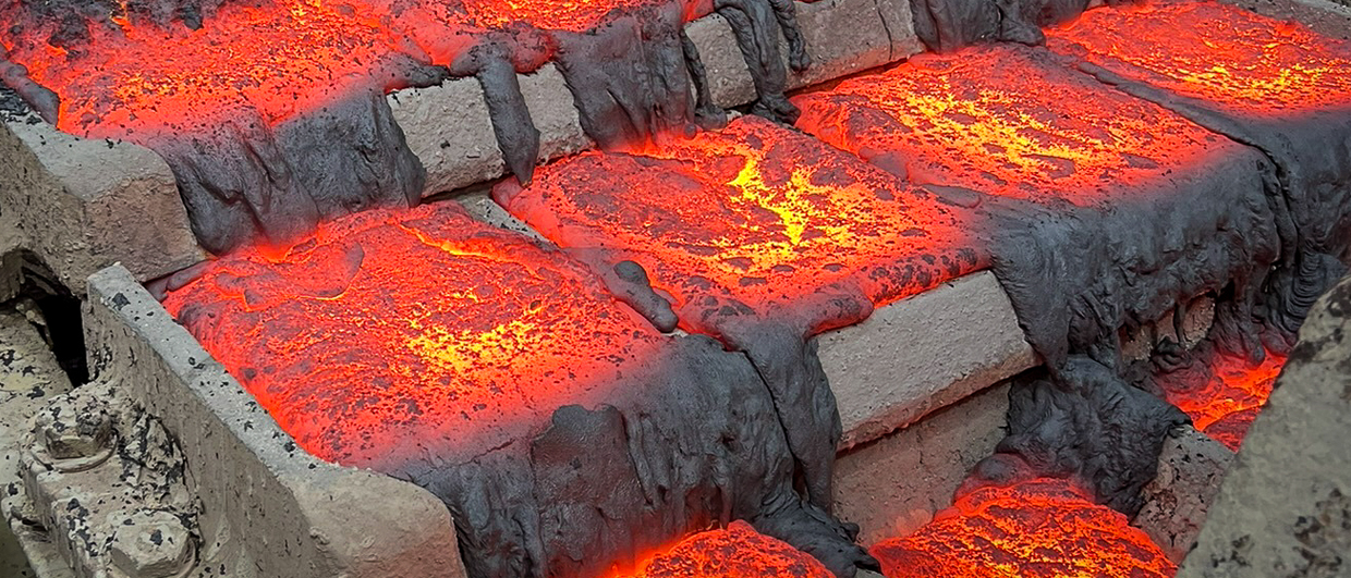
EMGS has developed a deep-towed EM streamer system that has been designed for marine mineral exploration. In addition to EM, the new system serves as a platform for the collection of numerous other data types close to the seabed. Some 100 km of EM data will be acquired.
In addition to the geophysical data outlined above, the ATLAB project plans to collect various environmental data, such as data on water currents, pressure, turbidity, conductivity, oxygen content, CO2 content, CH4 content, environmental DNA, underwater video and pictures. Whale observations will also be made, at the surface and using passive acoustic monitoring.
The Atlantic Laboratory consortium for the acquisition of geophysical research data (ATLAB) was started as an internally funded consortium at NTNU in 2016. ATLAB’s primary aim is to research the nature, dynamics and diversities of mid-ocean ridges and oceanic plates using state-of-the-art equipment and methodology. Previous expeditions have collected ultradeep passive magneto-telluric (MT) and controlled-source electromagnetic (CSEM) data.
EM has been done before
So far, ATLAB has acquired four datasets, two CSEM and two MT surveys, at the Mohns Ridge and Knipovich Ridge in the Norwegian-Greenland Sea. Results from the first survey were published in Nature in 2019 “Deep electrical imaging of the ultraslow-spreading Mohns Ridge | Nature”. The results from the northern Knipovich Ridge will be published in 2022.